Resources and News Tracking Homeless Camps through Mapping Technology
October 6, 2020
Most cities in California are facing the challenges that come with an increasing homeless population including litter, disease, environmental damages, public safety issues, affected property values, and, most significantly, the tole that that living on the street takes on the mental and physical health of these individuals. While resources and solutions are available, communication with and information on this population can be difficult to establish.
Working with the City of Rancho Cordova, Interwest GIS staff have created a map-based program to help document, track, and provide resources to homeless individuals and families. The Rancho Cordova Homeless Outreach Team (HOT), uses this tool to assist with identifying individuals in the homeless camps to provide resource information to potentially help them towards a more stable future.
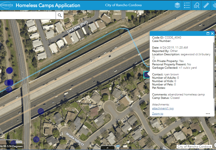
The map-based application was created to allow HOT team members to locate, document, and capture images to assist in understanding the magnitude, concentration, and details concerning the homeless camps throughout the community. Using the ArcGIS Collector app on their smartphones, City staff can quickly document the location, characteristics of the camp, and people living there.
The information that was collected in the field is viewed by staff back at the office. Users login into ArcGIS Online to access the Homeless Camps Application to review and analyze the recently collected information. This helps to direct resources for cleanup activity near street right of ways, highway interchanges, creek ways, and vacant lots.
The City’s Homeless Outreach Team, comprised of a Homeless Navigator, a code enforcement officer and two police officers, assist individuals and families experiencing homelessness in the community.
Note: During the COVID pandemic, the enforcement of illegal homeless camps has been put on hold.
Click here to learn more about our GIS team.